
🚀 宇宙の記憶・カレンダー検索
🚀 象徴的な写真:
APOD第1回
🚀 創造の柱
🚀 スピリット火星着陸
🚀 ハッブル超深宇宙
🚀 地球へようこそ|ブルー・マーブル
🚀 エンケラドス
🚀 ベテルギウス
🚀 火星着陸
🚀 青い夕焼け
🚀 冥王星のハート
🚀 皆既日食
🚀 アースライズ再構築
🚀 ブラックホール
🚀 ウェッブ初画像
🚀 アポロ11着陸
APOD30周年(2025年6月16日)
火星の丘
The Hills of Mars
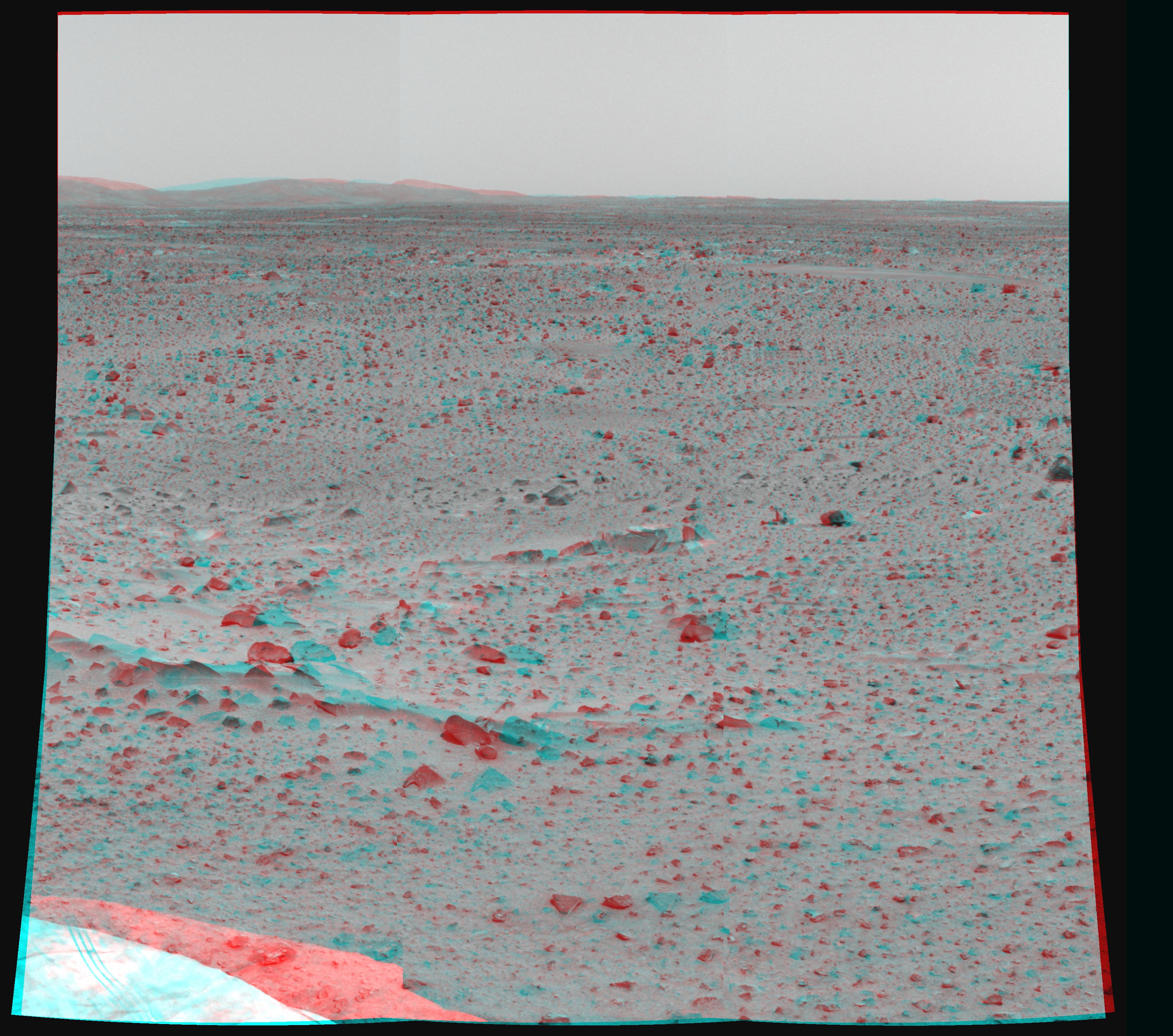
火星探査車スピリットが撮影したこの鮮明なステレオ画像には、岩だらけで風の吹き荒れる平原の上に、遠くの丘がそびえ立っている様子が写っています。赤と青のメガネをかけると、スピリットの高解像度パノラマカメラで撮影された左右の画像を合成し、迫力ある3D画像が得られます。丘は火星から約2キロメートル離れた場所にあり、高さは約50~100メートルと推定されています。地形の特徴に加え、丘の方向と距離を特定することで、火星周回軌道から撮影された高解像度画像と比較し、スピリットの着陸地点を正確に特定するのに役立ちます。探査車のカメラからは、立体的な形状、大きさ、距離などに関する重要な推定値が得られる、多くのステレオ画像データが期待されています。(編集者注:ステレオ画像を見るための赤と青のメガネは市販されているものもあれば、赤と青のプラスチックをフィルターとして使って自作することもできます。ぜひ試してみてください!この画像を見るには、左目に赤いフィルターを使用します。)
原文(English)
Distant hills rise above a rocky, windswept plain in this sharp stereo scene from the Spirit rover on Mars. When viewed with red/blue glasses, the picture combines left and right images from Spirit's high resolution panoramic camera to yield a dramatic 3D perspective. The hills were estimated to lie about 2 kilometers away and be approximately 50 to 100 meters high. Along with other features of the landscape, determining their direction and distance will help pinpoint the exact location of the Spirit landing site when compared with high resolution images of the region taken from Mars orbit. Much stereo image data, allowing important estimates of three dimensional shapes, sizes, and distances, is anticipated from the rover's cameras. (Editor's note: Red/blue glasses for viewing stereo pictures can be purchased or simply constructed using red and blue plastic for filters. Try it! To view this image, the red filter is used for the left eye.)
\ この感動を宇宙仲間にシェア /
宇宙をXでシェア
© NASA / APOD