
🚀 宇宙の記憶・カレンダー検索
🚀 象徴的な写真:
APOD第1回
🚀 創造の柱
🚀 スピリット火星着陸
🚀 ハッブル超深宇宙
🚀 地球へようこそ|ブルー・マーブル
🚀 エンケラドス
🚀 ベテルギウス
🚀 火星着陸
🚀 青い夕焼け
🚀 冥王星のハート
🚀 皆既日食
🚀 アースライズ再構築
🚀 ブラックホール
🚀 ウェッブ初画像
🚀 アポロ11着陸
APOD30周年(2025年6月16日)
火星の極多角形
Polar Polygons on Mars
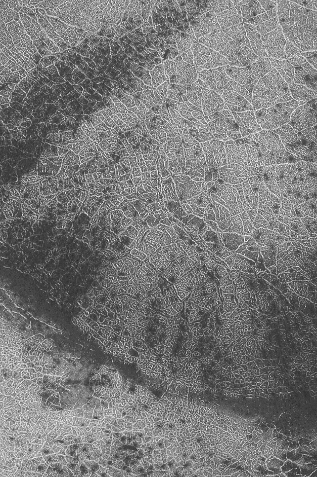
市街中心部への最適なルートは?地球上の都市の地図のように見えるものは、実は火星に自然に形成された断片的な極多角形の連なりです。火星に極多角形が存在することは特に興味深いことで、地表から数メートル以内に水氷が存在する領域を示している可能性があります。同様の多角形は地球の北極と南極でよく見られ、そこでは凍結と融解の繰り返しによって形成されます。上の画像は約3キロメートルに及び、最近火星周回探査機マーズ・グローバル・サーベイヤーによって撮影されました。
原文(English)
What's the best way to the city center? What looks like a street map of some city on Earth is actually a series of naturally-formed fragmented polar polygons on Mars. The existence of polar polygons on Mars is particularly interesting as they may indicate regions where water ice lies within a few meters of the surface. Similar looking polygons are commonly found in the arctic and Antarctic of Earth, where they typically form from a repetitive cycle of freezing and thawing. The above image spans a distance of about 3 kilometers and was taken recently by the orbiting Mars Global Surveyor.
\ この感動を宇宙仲間にシェア /
宇宙をXでシェア
© Malin Space Science Systems,
MOC,
MGS,
JPL,
NASA / APOD