
🚀 宇宙の記憶・カレンダー検索
🚀 象徴的な写真:
APOD第1回
🚀 創造の柱
🚀 スピリット火星着陸
🚀 ハッブル超深宇宙
🚀 地球へようこそ|ブルー・マーブル
🚀 エンケラドス
🚀 ベテルギウス
🚀 火星着陸
🚀 青い夕焼け
🚀 冥王星のハート
🚀 皆既日食
🚀 アースライズ再構築
🚀 ブラックホール
🚀 ウェッブ初画像
🚀 アポロ11着陸
APOD30周年(2025年6月16日)
ニュージーランド上空のレンズ雲
A Lenticular Cloud Over New Zealand
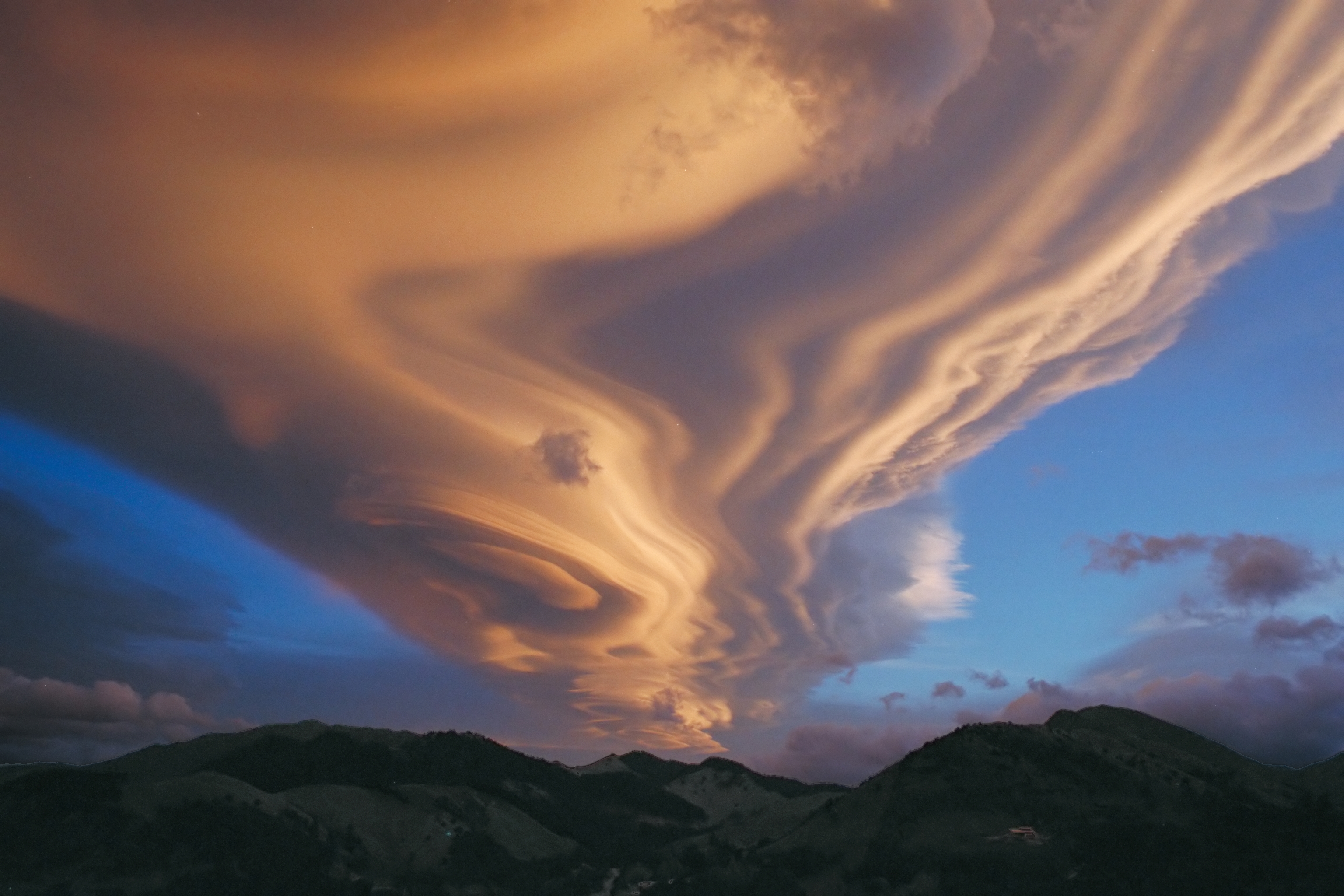
あの山々の上空では何が起こっているのでしょうか?複数の雲が重なり合って、印象的なレンズ雲を形成しています。通常、空気は垂直方向よりも水平方向に大きく移動します。しかし、山や丘から風が吹いてくる時など、空気が安定するにつれて比較的強い垂直方向の振動が発生することがあります。振動の頂点にある乾燥した空気は、水分含有量が層状に分かれている場合があり、そのため、空気が水分で飽和する各層に雲が形成されます。その結果、層がはっきりと見えるレンズ雲が生まれるのです。上の写真は、2002年にニュージーランド北島からタラルア山脈を南西方向に撮影したものです。
原文(English)
What's happening above those mountains? Several clouds are stacked up into one striking lenticular cloud. Normally, air moves much more horizontally than it does vertically. Sometimes, however, such as when wind comes off of a mountain or a hill, relatively strong vertical oscillations take place as the air stabilizes. The dry air at the top of an oscillation may be quite stratified in moisture content, and hence forms clouds at each layer where the air saturates with moisture. The result can be a lenticular cloud with a strongly layered appearance. The above picture was taken in 2002 looking southwest over the Tararua Range mountains from North Island, New Zealand.
\ この感動を宇宙仲間にシェア /
宇宙をXでシェア
© Chris Picking / APOD