
🚀 宇宙の記憶・カレンダー検索
🚀 象徴的な写真:
APOD第1回
🚀 創造の柱
🚀 スピリット火星着陸
🚀 ハッブル超深宇宙
🚀 地球へようこそ|ブルー・マーブル
🚀 エンケラドス
🚀 ベテルギウス
🚀 火星着陸
🚀 青い夕焼け
🚀 冥王星のハート
🚀 皆既日食
🚀 アースライズ再構築
🚀 ブラックホール
🚀 ウェッブ初画像
🚀 アポロ11着陸
APOD30周年(2025年6月16日)
アンナプルナの星の軌跡
Annapurna Star Trails
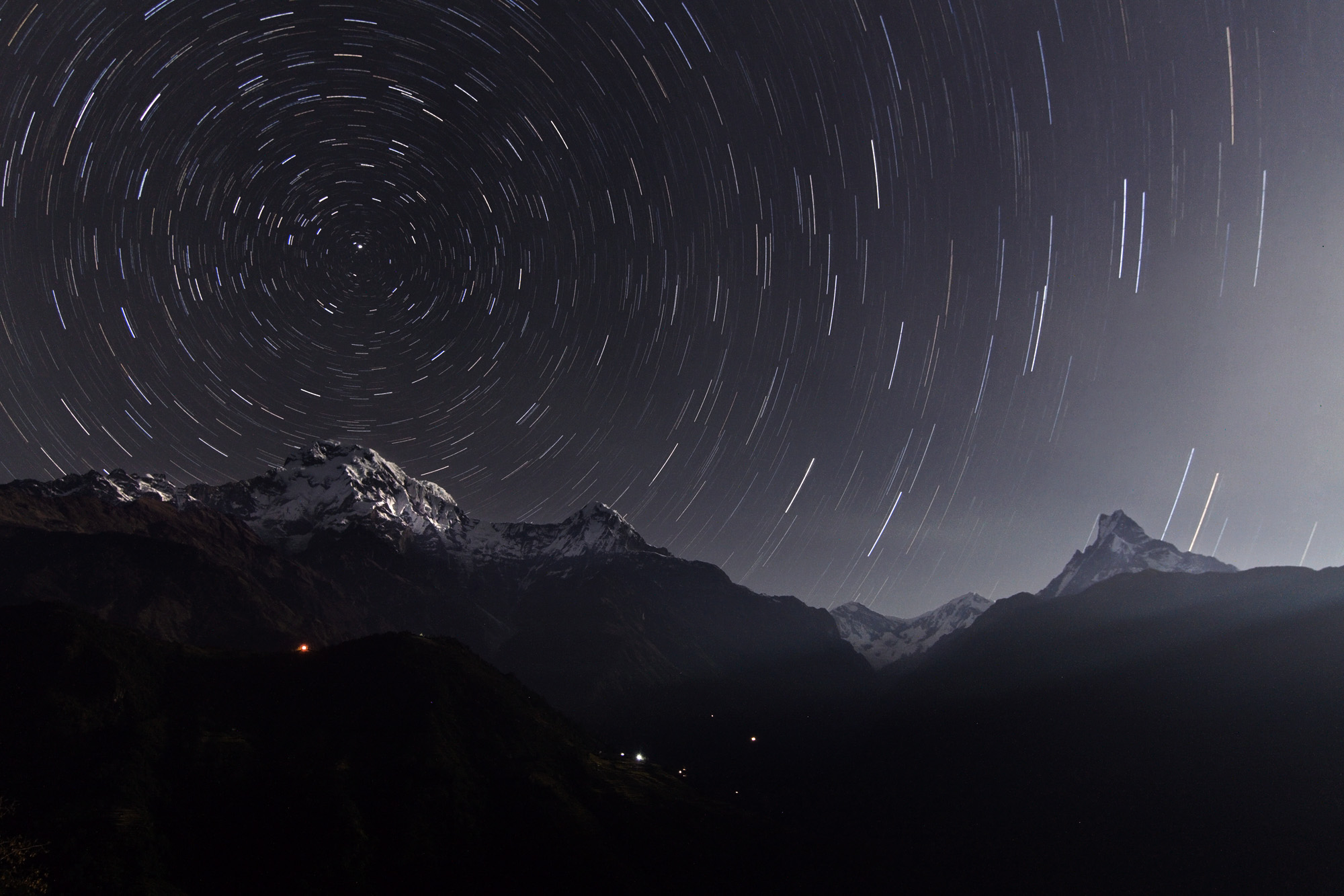
神話では、アトラスは天を支えている。しかし、この月明かりに照らされた山岳風景では、ネパールのガンドルクから見たヒマラヤ山脈のアンナプルナ連峰が空を支えているように見える。左から右へ、3つの主要な峰はアンナプルナ南峰(7,219メートル)、ヒウンチュリ峰(6,441メートル)、マチャプチャレ峰(6,995メートル)である。もちろん、動いているのは星ではなく山々であり、地球の自転によって長時間露光で記録された同心円状の星の軌跡が生じている。アンナプルナ南峰の上方に位置する北天の極は、すべての星の軌跡の弧の中心点として容易に識別できる。北極星としても知られるポラリスは、北天の極に最も近い非常に短く明るい弧を描いている。
原文(English)
In myth, Atlas holds up the heavens. But in this moonlit mountainscape, peaks of the Himalayan Annapurna Range appear to prop up the sky as seen from Ghandruk, Nepal. From left to right the three main peaks are Annapurna South (7,219 meters), Hiunchuli (6,441 meters), and Machapuchare (6,995 meters). Of course the mountains are moving not the stars, the Earth's rotation about its axis causing the concentric star trails recorded in the time exposure. Positioned above Annapurna South, the North Celestial Pole is easily identified as the point at the center of all the star trail arcs. The star Polaris, also known as the North Star, made the very short and bright arc closest to the North Celestial Pole.
\ この感動を宇宙仲間にシェア /
宇宙をXでシェア
© Jia Hao / APOD