
🚀 宇宙の記憶・カレンダー検索
🚀 象徴的な写真:
APOD第1回
🚀 創造の柱
🚀 スピリット火星着陸
🚀 ハッブル超深宇宙
🚀 地球へようこそ|ブルー・マーブル
🚀 エンケラドス
🚀 ベテルギウス
🚀 火星着陸
🚀 青い夕焼け
🚀 冥王星のハート
🚀 皆既日食
🚀 アースライズ再構築
🚀 ブラックホール
🚀 ウェッブ初画像
🚀 アポロ11着陸
APOD30周年(2025年6月16日)
ウィスコンシン州上空のロール雲
A Roll Cloud Over Wisconsin
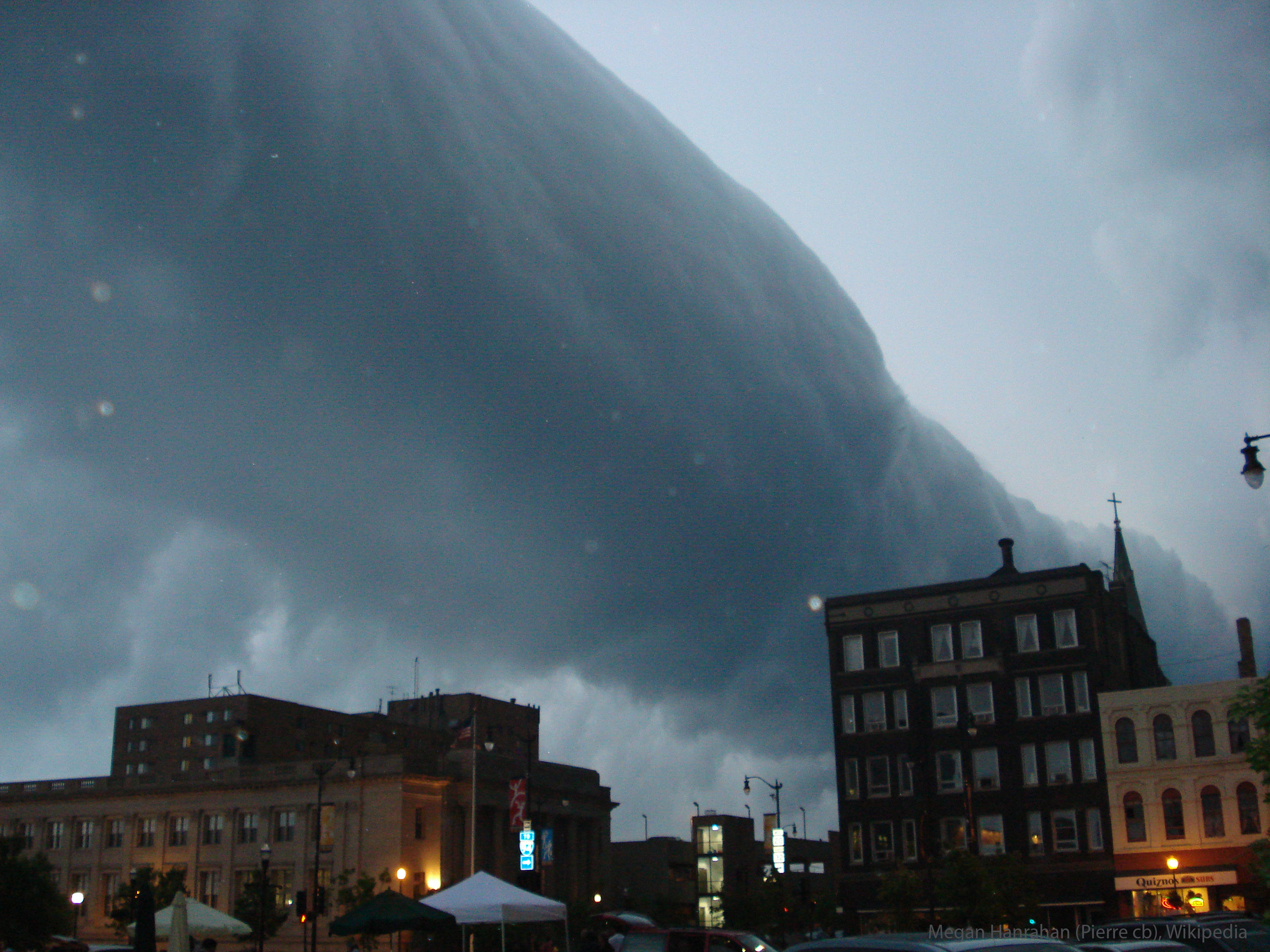
これはどんな雲でしょうか? ロール雲と呼ばれる弧状雲の一種です。このような珍しい長い雲は、寒冷前線が接近している付近で発生することがあります。特に、接近する嵐の前線からの下降気流によって湿った暖かい空気が上昇し、露点以下に冷やされて雲が形成されることがあります。これが広範囲にわたる前線に沿って均一に起こると、ロール雲が形成されることがあります。ロール雲では、雲の長い水平軸に沿って空気が循環している場合があります。ロール雲は竜巻に変化することはないと考えられています。似たような棚雲とは異なり、ロール雲は親となる積乱雲から完全に分離しています。ここに掲載されている写真は、2007年に米国ウィスコンシン州ラシーンで嵐が接近するにつれて、ロール雲が遠くまで伸びている様子です。
原文(English)
What kind of cloud is this? A type of arcus cloud called a roll cloud. These rare long clouds may form near advancing cold fronts. In particular, a downdraft from an advancing storm front can cause moist warm air to rise, cool below its dew point, and so form a cloud. When this happens uniformly along an extended front, a roll cloud may form. Roll clouds may actually have air circulating along the long horizontal axis of the cloud. A roll cloud is not thought to be able to morph into a tornado. Unlike a similar shelf cloud, a roll cloud is completely detached from their parent cumulonimbus cloud. Pictured here, a roll cloud extends far into the distance as a storm approaches in 2007 in Racine, Wisconsin, USA.
\ この感動を宇宙仲間にシェア /
宇宙をXでシェア
© NASA / APOD