
🚀 宇宙の記憶・カレンダー検索
🚀 象徴的な写真:
APOD第1回
🚀 創造の柱
🚀 スピリット火星着陸
🚀 ハッブル超深宇宙
🚀 地球へようこそ|ブルー・マーブル
🚀 エンケラドス
🚀 ベテルギウス
🚀 火星着陸
🚀 青い夕焼け
🚀 冥王星のハート
🚀 皆既日食
🚀 アースライズ再構築
🚀 ブラックホール
🚀 ウェッブ初画像
🚀 アポロ11着陸
APOD30周年(2025年6月16日)
ソリス平原のクレーター壁
Crater Wall on Solis Planum
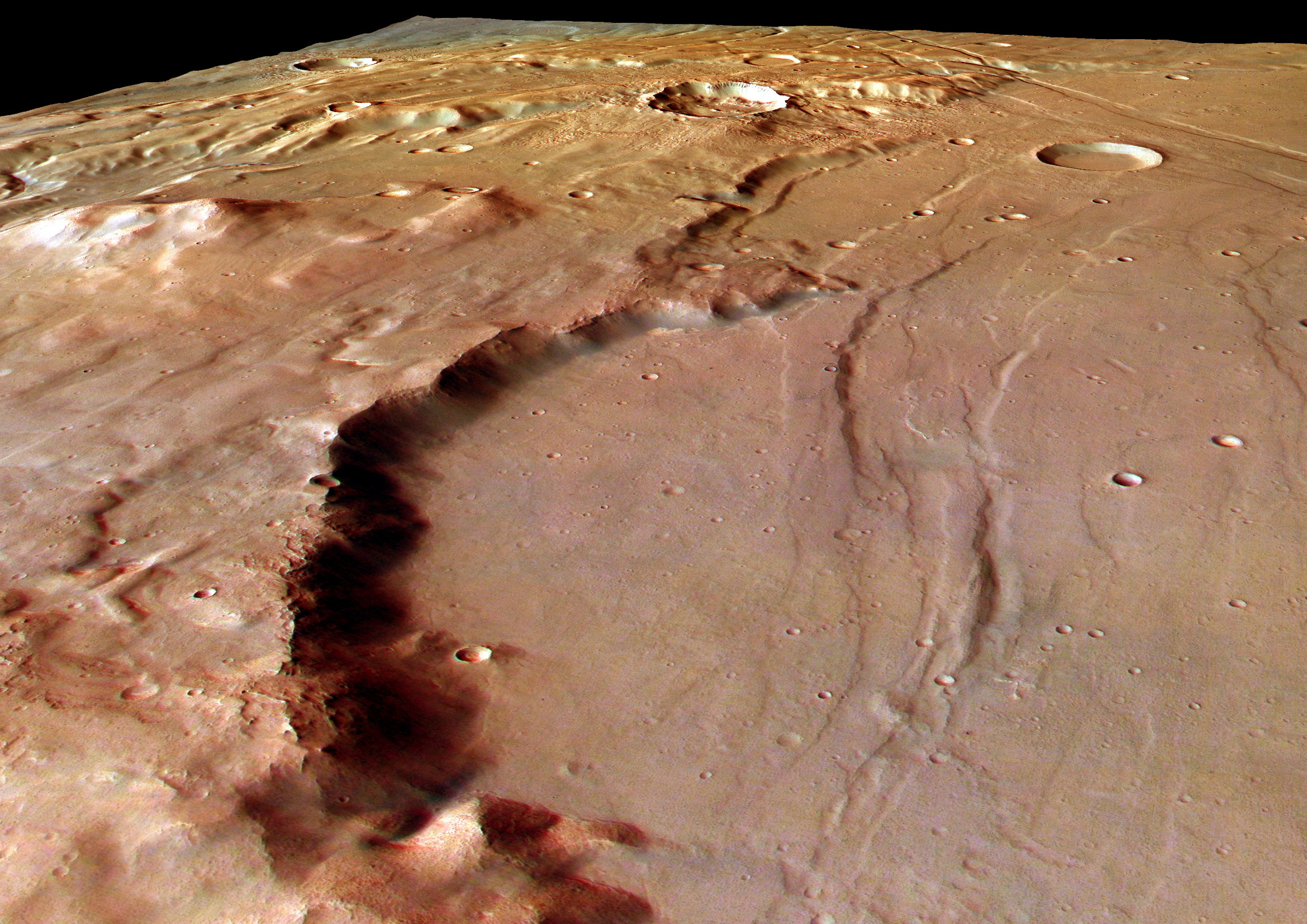
この劇的な遠近法による画像は、火星の山岳地帯タウマシア地域に隣接するソリス・プラヌムにある、侵食された巨大な衝突クレーターの壁に沿って南東方向を捉えたものです。画面奥約50キロメートルに及ぶクレーターの壁は、高さ約800メートルです。火星の壮大なマリネリス峡谷のすぐ南西に位置するこの地域には、地表プレートの動き、すなわちプレートテクトニクスの証拠とされる山々と断層線が見られます。プレートテクトニクスは地球の表面を長年にわたって形成してきましたが、火星ではごく短期間しか活動していなかったと考えられています。この画像は、ESAの火星探査機マーズ・エクスプレスに搭載された高解像度ステレオカメラのカラー画像データを用いて作成されました。
原文(English)
This dramatic perspective view looks south-east along the wall of a large eroded impact crater on Solis Planum, bordering the mountainous Thaumasia region of Mars. Stretching for about 50 kilometers into the scene, the crater wall is around 800 meters high. Located just south and west of the Red Planet's grand Valles Marineris, this area features mountains and fault lines that are seen as evidence of surface plate motions or plate tectonics. The process of plate tectonics has long been shaping the surface of planet Earth but is thought to have been only briefly active on Mars. The image was constructed using color image data from the High Resolution Stereo Camera onboard ESA's Mars Express spacecraft.
\ この感動を宇宙仲間にシェア /
宇宙をXでシェア
© NASA / APOD