
🚀 宇宙の記憶・カレンダー検索
🚀 象徴的な写真:
APOD第1回
🚀 創造の柱
🚀 スピリット火星着陸
🚀 ハッブル超深宇宙
🚀 地球へようこそ|ブルー・マーブル
🚀 エンケラドス
🚀 ベテルギウス
🚀 火星着陸
🚀 青い夕焼け
🚀 冥王星のハート
🚀 皆既日食
🚀 アースライズ再構築
🚀 ブラックホール
🚀 ウェッブ初画像
🚀 アポロ11着陸
APOD30周年(2025年6月16日)
オーストラリア上空の朝顔色の雲
Morning Glory Clouds Over Australia
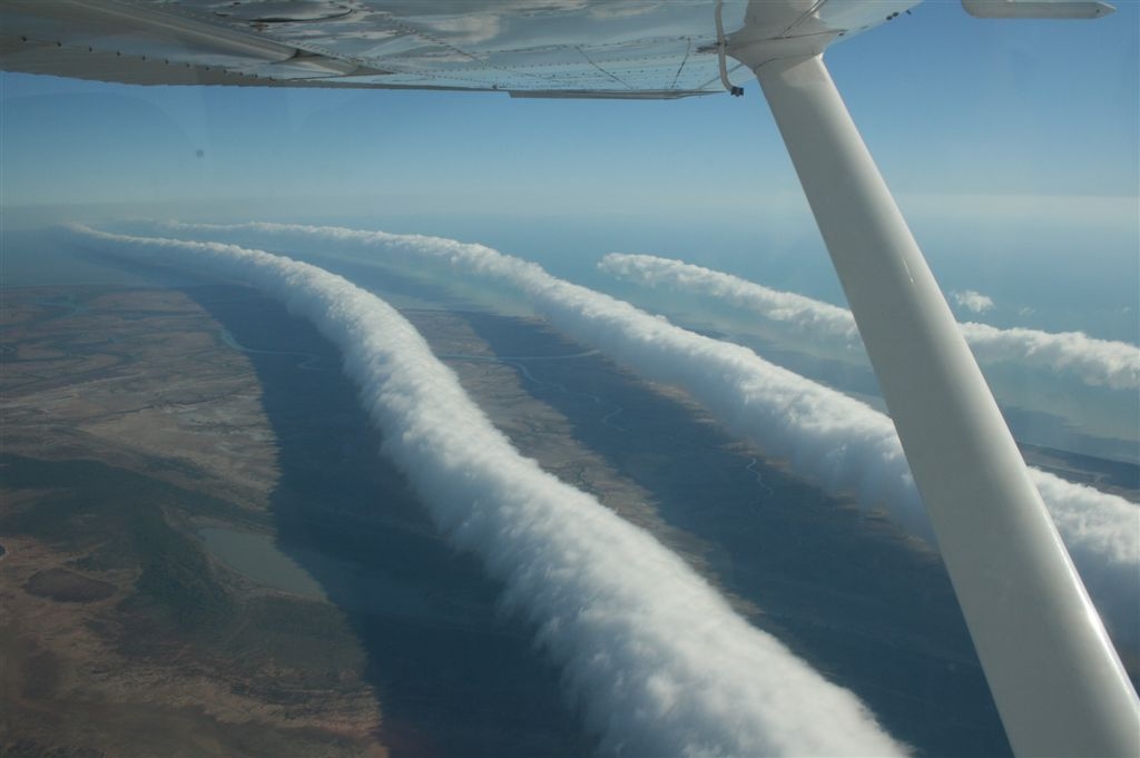
これらの長く奇妙な雲は何が原因なのでしょうか?誰も確信していません。モーニンググローリー雲として知られる珍しいタイプの雲は、長さが1,000キロメートルにも達し、高度2キロメートルまで発生することがあります。同様のロール雲は世界各地の特定の場所で見られていますが、オーストラリアのクイーンズランド州バークタウン上空のものは毎年春に必ず発生します。長く水平に循環する空気のチューブは、流れている湿った冷たい空気が逆転層、つまり高度とともに気温が異常に上昇する大気層に遭遇したときに形成される可能性があります。これらのチューブと周囲の空気は、晴れているときに飛行機にとって危険な乱気流を引き起こす可能性があります。モーニンググローリー雲は、ほとんど風のない地表で時速60キロメートルの対気速度に達することがあると報告されています。上の写真は、写真家のミック・ペトロフがオーストラリアのカーペンタリア湾付近で飛行機から撮影したモーニンググローリー雲です。
原文(English)
What causes these long, strange clouds? No one is sure. A rare type of cloud known as a Morning Glory cloud can stretch 1,000 kilometers long and occur at altitudes up to two kilometers high. Although similar roll clouds have been seen at specific places across the world, the ones over Burketown, Queensland Australia occur predictably every spring. Long, horizontal, circulating tubes of air might form when flowing, moist, cooling air encounters an inversion layer, an atmospheric layer where air temperature atypically increases with height. These tubes and surrounding air could cause dangerous turbulence for airplanes when clear. Morning Glory clouds can reportedly achieve an airspeed of 60 kilometers per hour over a surface with little discernible wind. Pictured above, photographer Mick Petroff photographed some Morning Glory clouds from his airplane near the Gulf of Carpentaria, Australia.
\ この感動を宇宙仲間にシェア /
宇宙をXでシェア
© NASA / APOD