
🚀 宇宙の記憶・カレンダー検索
🚀 象徴的な写真:
APOD第1回
🚀 創造の柱
🚀 スピリット火星着陸
🚀 ハッブル超深宇宙
🚀 地球へようこそ|ブルー・マーブル
🚀 エンケラドス
🚀 ベテルギウス
🚀 火星着陸
🚀 青い夕焼け
🚀 冥王星のハート
🚀 皆既日食
🚀 アースライズ再構築
🚀 ブラックホール
🚀 ウェッブ初画像
🚀 アポロ11着陸
APOD30周年(2025年6月16日)
ウルグアイ上空の渦巻き雲
A Roll Cloud Over Uruguay
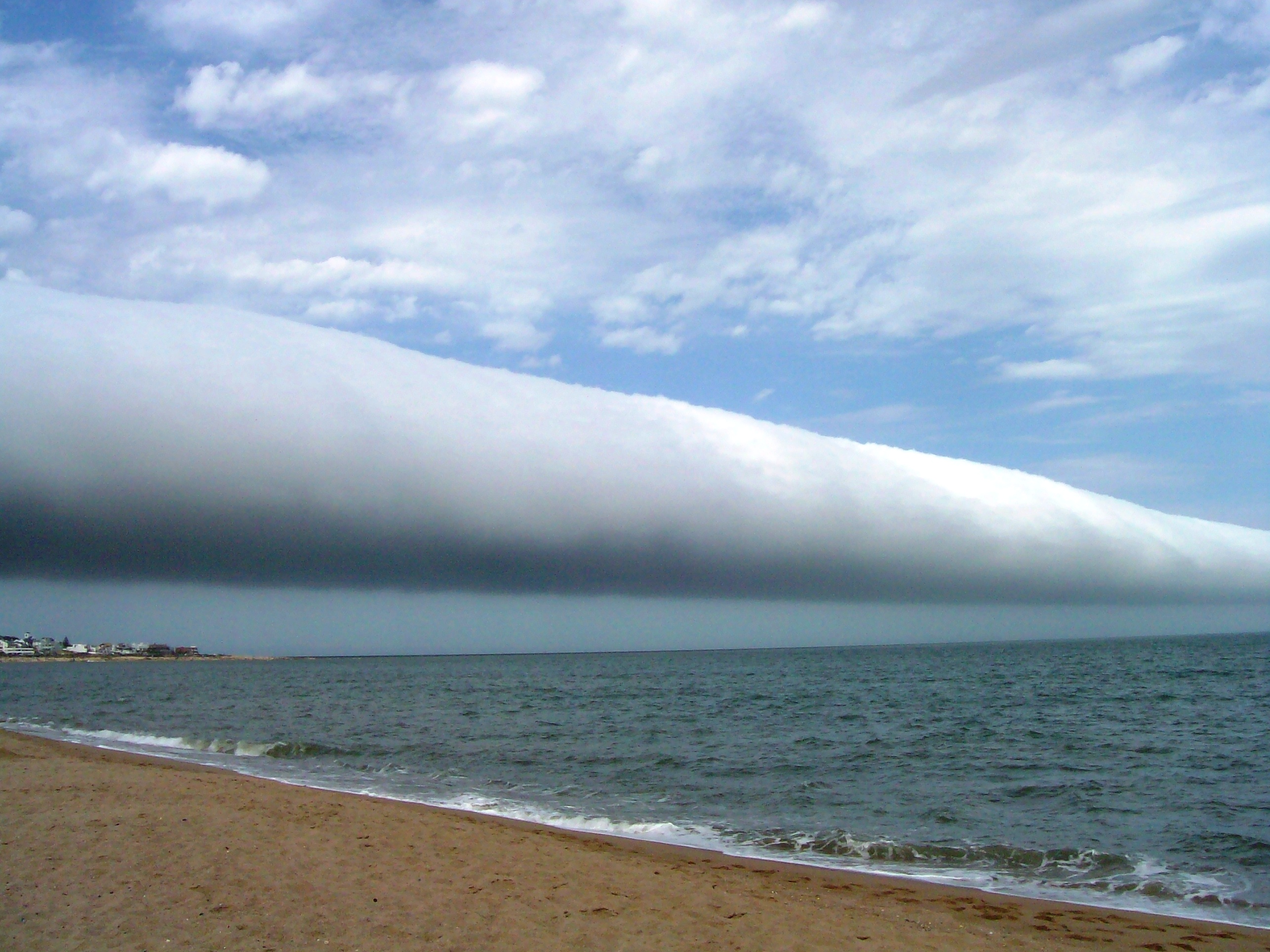
これはどんな雲でしょうか? ロール雲です。このような珍しい長い雲は、前進する寒冷前線の近くで形成されることがあります。特に、前進する嵐の前線からの下降気流によって、湿った暖かい空気が上昇し、露点以下に冷えて雲を形成することがあります。これが長い前線に沿って均一に起こると、ロール雲が形成されることがあります。ロール雲では、実際には雲の長い水平軸に沿って空気が循環していることがあります。ロール雲は竜巻に変化することはないと考えられています。類似の棚雲とは異なり、アーカス雲の一種であるロール雲は、親となる積乱雲から完全に分離しています。上の写真は、2009年1月にウルグアイのマルドナドにあるラス・オラス・ビーチの上空に遠くまで伸びるロール雲です。注:APOD編集者が、1月8日(金)にニューヨーク市のアメリカ自然史博物館で開催されるニューヨークアマチュア天文協会主催のイベントで、2009年の天文画像をレビューします。
原文(English)
What kind of cloud is this? A roll cloud. These rare long clouds may form near advancing cold fronts. In particular, a downdraft from an advancing storm front can cause moist warm air to rise, cool below its dew point, and so form a cloud. When this happens uniformly along an extended front, a roll cloud may form. Roll clouds may actually have air circulating along the long horizontal axis of the cloud. A roll cloud is not thought to be able to morph into a tornado. Unlike a similar shelf cloud, a roll cloud, a type of Arcus cloud, is completely detached from their parent cumulonimbus cloud. Pictured above, a roll cloud extends far into the distance in 2009 January above Las Olas Beach in Maldonado, Uruguay. Note: An APOD editor will review astronomy images of 2009, hosted by the Amateur Astronomers Association of New York on Friday, January 8 at the American Museum of Natural History, NYC.
\ この感動を宇宙仲間にシェア /
宇宙をXでシェア
© roll cloud / APOD