A Roll Cloud Over Uruguay
A Roll Cloud Over Uruguay
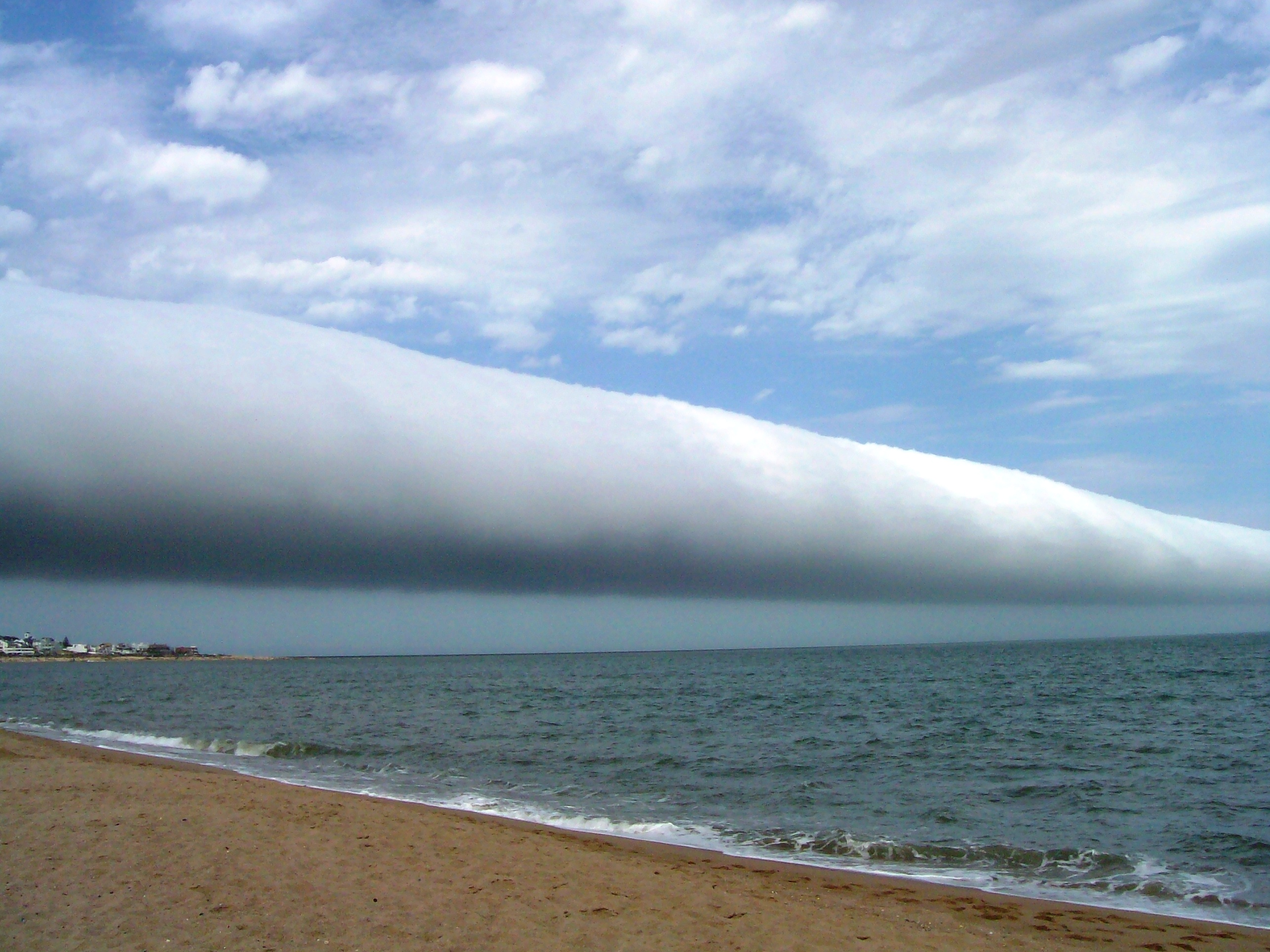
What kind of cloud is this? A roll cloud. These rare long clouds may form near advancing cold fronts. In particular, a downdraft from an advancing storm front can cause moist warm air to rise, cool below its dew point, and so form a cloud. When this happens uniformly along an extended front, a roll cloud may form. Roll clouds may actually have air circulating along the long horizontal axis of the cloud. A roll cloud is not thought to be able to morph into a tornado. Unlike a similar shelf cloud, a roll cloud, a type of Arcus cloud, is completely detached from their parent cumulonimbus cloud. Pictured above, a roll cloud extends far into the distance in 2009 January above Las Olas Beach in Maldonado, Uruguay. Note: An APOD editor will review astronomy images of 2009, hosted by the Amateur Astronomers Association of New York on Friday, January 8 at the American Museum of Natural History, NYC.
原文(English)
What kind of cloud is this? A roll cloud. These rare long clouds may form near advancing cold fronts. In particular, a downdraft from an advancing storm front can cause moist warm air to rise, cool below its dew point, and so form a cloud. When this happens uniformly along an extended front, a roll cloud may form. Roll clouds may actually have air circulating along the long horizontal axis of the cloud. A roll cloud is not thought to be able to morph into a tornado. Unlike a similar shelf cloud, a roll cloud, a type of Arcus cloud, is completely detached from their parent cumulonimbus cloud. Pictured above, a roll cloud extends far into the distance in 2009 January above Las Olas Beach in Maldonado, Uruguay. Note: An APOD editor will review astronomy images of 2009, hosted by the Amateur Astronomers Association of New York on Friday, January 8 at the American Museum of Natural History, NYC.
\ この感動を宇宙仲間にシェア /
宇宙をXでシェア
© roll cloud / APOD