静止軌道高速道路
Geostationary Highway
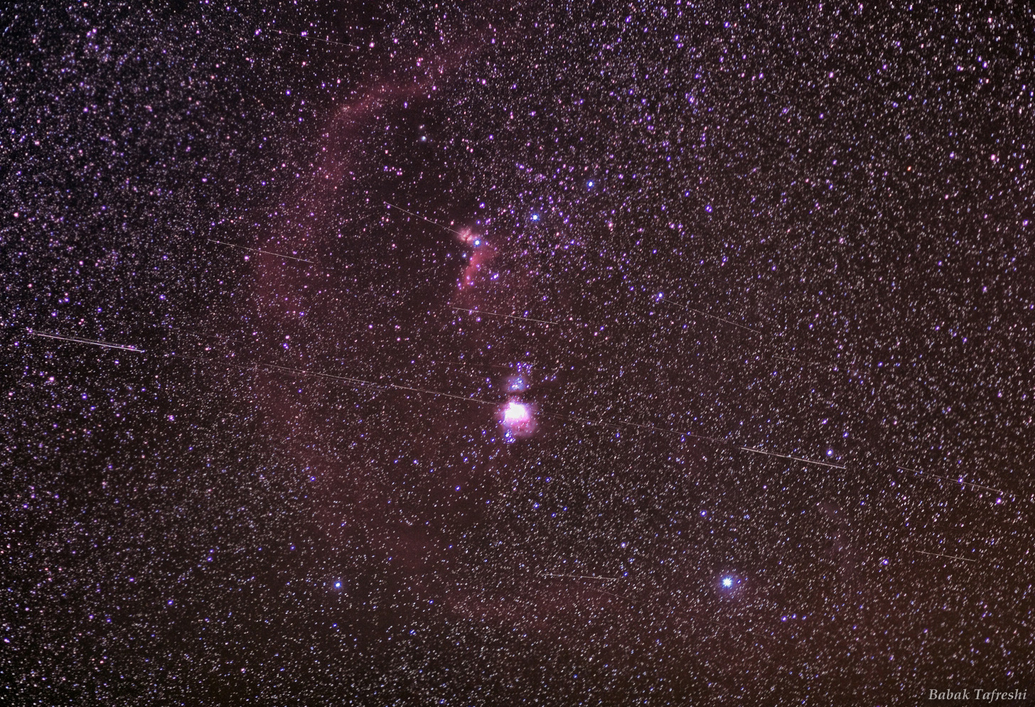
地球の中心から約42,000キロメートル(地表から約36,000キロメートル)の円軌道に衛星を配置すると、24時間で1周します。これは地球の自転周期と一致するため、静止軌道と呼ばれます。この軌道が赤道面上にある場合、衛星は静止軌道上の固定された位置の上空に留まります。1940年代に未来学者アーサー・C・クラークが予言したように、静止軌道は通信衛星や気象衛星に広く利用されており、これは現在では天体写真家にはよく知られたシナリオです。星を追尾する望遠鏡で撮影された夜空の深宇宙画像には、地球表面のはるか上空で太陽光に照らされて輝く静止衛星も写し出されます。衛星はすべて星空を背景に地球の自転に合わせて移動するため、衛星は天体風景を横切る高速道路のような軌跡を残します。例えば、この赤道付近のオリオン座領域の広角画像では、個々のフレームを合成して10分間の露光時間で撮影されています。オリオン座の三つ星や有名な星雲に加え、2.5度ほどの長さの静止衛星の軌跡が多数写っています。これらのフレームは、静止衛星の軌跡を捉えた独創的な動画から抜粋したものです。
原文(English)
Put a satellite in a circular orbit about 42,000 kilometers from the center of the Earth (36,000 kilometers or so above the surface) and it will orbit once in 24 hours. Because that matches Earth's rotation period, it is known as a geosynchronous orbit. If that orbit is also in the plane of the equator, the satellite will hang in the sky over a fixed location in a geostationary orbit. As predicted in the 1940s by futurist Arthur C. Clarke, geostationary orbits are in common use for communication and weather satellites, a scenario now well-known to astroimagers. Deep images of the night sky made with telescopes that follow the stars can also pick up geostationary satellites glinting in sunlight still shining far above the Earth's surface. Because they all move with the Earth's rotation against the background of stars, the satellites leave trails that seem to follow a highway across the celestial landscape. For example, in this wide view of the nearly equatorial Orion region, individual frames were added to create a 10 minute long exposure. It shows Orion's belt stars and well-known nebulae along with many 2.5 degree long geostationary satellite trails. The frames are from an ingenious movie, featuring the geostationary satellite highway.
\ この感動を宇宙仲間にシェア /
宇宙をXでシェア
© Babak Tafreshi / APOD