パン・スターズ・アクロス・ザ・スカイ
Pan-STARRS Across the Sky
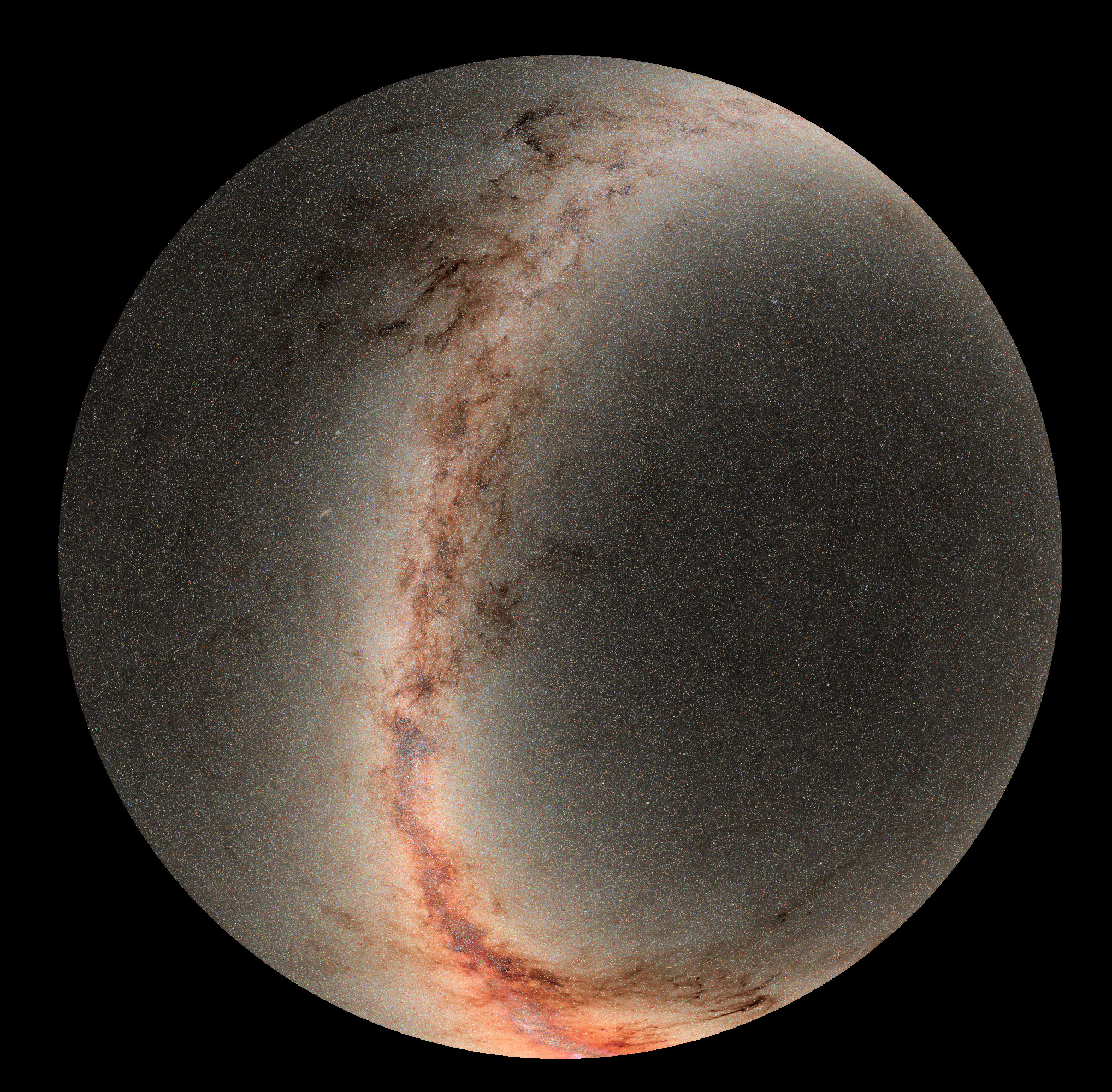
この天体観測による全天ビューは、Pan-STARRS観測所によるモザイク画像です。画像は、地球のマウイ島にあるハレアカラ山頂に設置された1.8メートル望遠鏡で撮影されました。実際、この全天投影図の中心には地球の北天極が位置しています。ハワイ諸島から見た南の地平線の限界である赤緯-30度が、円形の外縁を規定しています。天の川銀河の平面に沿って密集した星野と宇宙塵の雲が画面全体に広がり、下部には銀河中心の明るい膨らみが見られます。4年かけて収集された画像データは、現在地球上で最大のデジタル全天サーベイであるPan-STARRS(Panoramic Survey Telescope & Rapid Response System)のデータの第2版を表しています。2017年には、Pan-STARRSが太陽系を訪れた「オウムアムア」の星間航行を初めて認識するために使用されました。
原文(English)
This astronomical sky spanning view is a mosaic from the Pan-STARRS observatory. The images were recorded with its 1.8 meter telescope at the summit of Haleakala on planet Earth's island of Maui. In fact, Earth's north celestial pole is centered in this across-the-sky projection. A declination of -30 degrees, the southern horizon limit as seen from the Hawaiian Valley Isle, defines the circular outer edge. Crowded starfields and cosmic dust clouds along the plane of our Milky Way galaxy stretch across the scene with the bright bulge of the galactic center at the bottom. Compiled over four years, the image data represent the second edition of data from Pan-STARRS (Panoramic Survey Telescope & Rapid Response System), currently the planet's largest digital sky survey. In 2017 Pan-STARRS was used to first recognize the interstellar voyage of 'Oumuamua, visitor to our Solar System.
\ この感動を宇宙仲間にシェア /
宇宙をXでシェア
© NASA / APOD