火星の古代オガンクィットビーチ
Ancient Ogunquit Beach on Mars
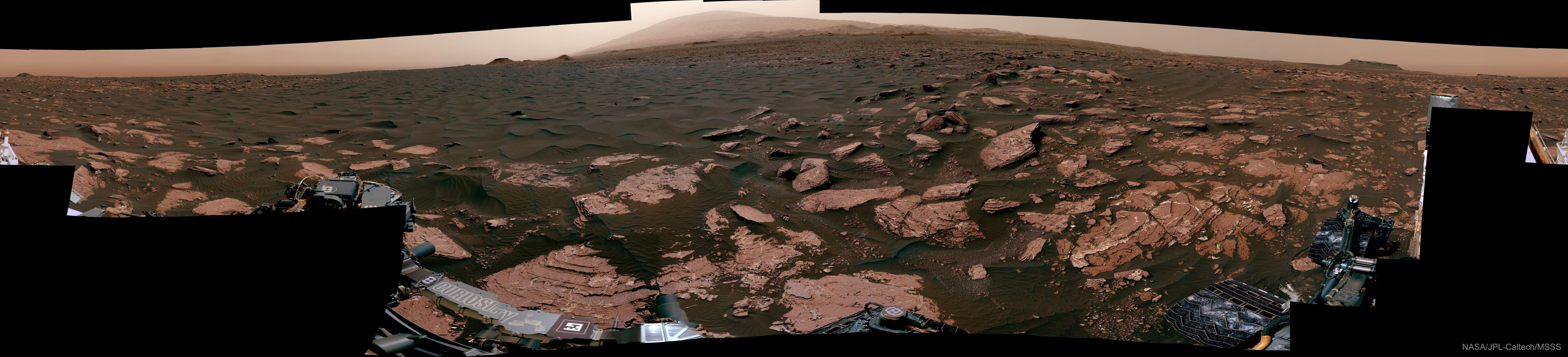
ここはかつて火星の古代のビーチでした。掲載されている水平方向に圧縮された360度パノラマ写真は、火星を探査したロボット探査車キュリオシティが2017年に撮影したものです。地球上のオガンキットビーチにちなんで名付けられたこの場所は、かつては水没していた時期もあれば、古代の湖の端だった時期もあったことが証拠から示されています。中央奥に見える明るい山頂は、キュリオシティが探査したゲール・クレーターの中心地形であるシャープ山の頂上です。前景の暗い砂の一部は分析のために採取されました。明るい色の岩盤は、現在干上がった湖底に堆積した堆積物で構成されていると考えられます。掲載されているパノラマ写真(インタラクティブ版はこちら)は100枚以上の画像から作成され、左下には探査車による署名があるようです。
原文(English)
This was once a beach -- on ancient Mars. The featured 360-degree panorama, horizontally compressed, was taken in 2017 by the robotic Curiosity rover that explored the red planet. Named Ogunquit Beach after its terrestrial counterpart, evidence shows that at times long ago the area was underwater, while at other times it was at the edge of an ancient lake. The light peak in the central background is the top of Mount Sharp, the central feature in Gale Crater where Curiosity explored. Portions of the dark sands in the foreground were scooped up for analysis. The light colored bedrock is composed of sediment that likely settled at the bottom of the now-dried lakebed. The featured panorama (interactive version here) was created from over 100 images and seemingly signed by the rover on the lower left.
\ この感動を宇宙仲間にシェア /
宇宙をXでシェア
© NASA / APOD