月の南極にできる影
Shadows at the Moon's South Pole
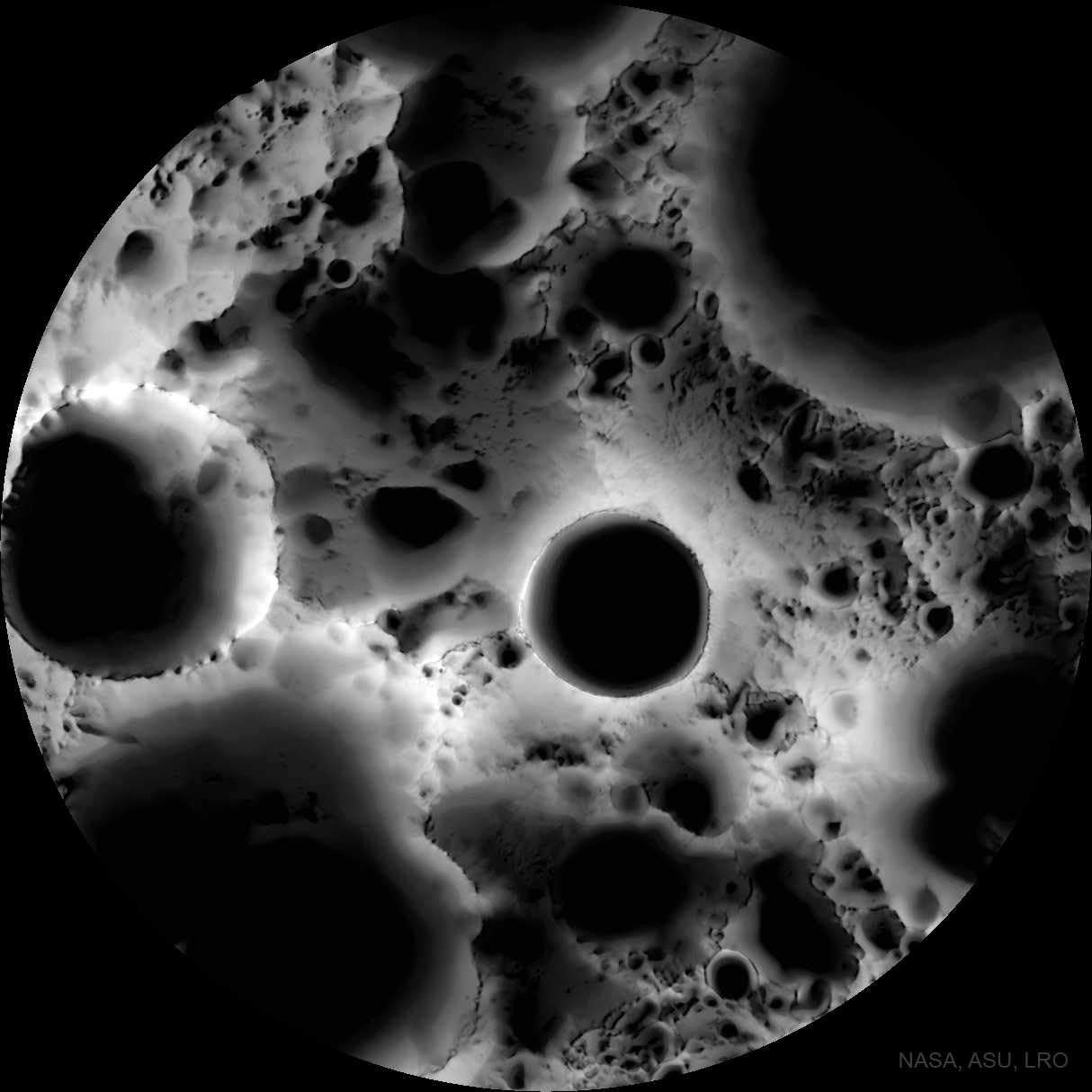
この月面画像は顕微鏡で撮影されたものですか?いいえ、広角カメラで撮影された複数時期の照明マップです。このマップを作成するために、月周回探査機ルナー・リコネサンス・オービターは、6月の期間(地球の6ヶ月)にわたって1,700枚の画像を収集し、月の南極を中心とした領域をさまざまな角度から繰り返し撮影しました。得られた画像を重ね合わせることで、このマップが作成されました。このマップは、月面の各地点が太陽光に照らされていた時間の割合を示しています。マップの中心付近には、直径19キロメートルのシャクルトン・クレーターの底がはっきりと影に覆われているのが見えます。月の南極自体は、クレーターの縁の9時方向あたりにあります。月の南極と北極付近のクレーターの底は永久影になることがありますが、山頂はほぼ常に太陽光に照らされます。将来の拠点として役立つ可能性のある、日陰になっているクレーターの底は氷の貯水池となる可能性があり、一方、日当たりの良い山頂は太陽光発電に適した場所となる。
原文(English)
Was this image of the Moon's surface taken with a microscope? No -- it's a multi-temporal illumination map made with a wide-angle camera. To create it, the Lunar Reconnaissance Orbiter spacecraft collected 1,700 images over a period of 6 lunar days (6 Earth months), repeatedly covering an area centered on the Moon's south pole from different angles. The resulting images were stacked to produce the featured map -- representing the percentage of time each spot on the surface was illuminated by the Sun. Remaining convincingly in shadow, the floor of the 19-kilometer diameter Shackleton crater is seen near the map's center. The lunar south pole itself is at about 9 o'clock on the crater's rim. Crater floors near the lunar south and north poles can remain in permanent shadow, while mountain tops can remain in nearly continuous sunlight. Useful for future outposts, the shadowed crater floors could offer reservoirs of water-ice, while the sunlit mountain tops offer good locations to collect solar power.
\ この感動を宇宙仲間にシェア /
宇宙をXでシェア
© NASA / APOD